Innovation: Using lasers to measure the wind

Idea
 Engineers used to rely on meteorological towers to measure wind speed. But “met towers” only give you data for one location; they don’t tell you anything about wind velocities around a valley or along a ridge. Wind 3D, a product being developed by
Oceanit, creates three-dimensional maps of wind velocities within a radius of three miles.
Technology
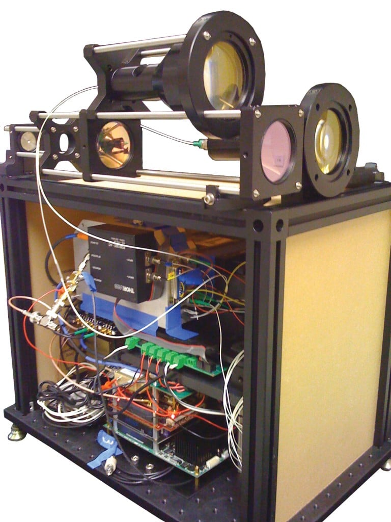
Wind 3D uses LIDAR — light detecting and ranging — a laser technology that bounces light off particles in the air, or even off air molecules themselves, to measure wind velocity. “It’s quite mind boggling,” says principal investigator Chris Sullivan. “The design of the system is to get back like one-billionth of the light that you sent out.”
History
LIDAR isn’t new, but Oceanit innovations have created a smaller, cheaper and more reliable package. According to marketing manager Ian Kitajima, Oceanit originally developed LIDAR systems under government contract to help unmanned airplanes drop propaganda leaflets accurately. Later, they used similar technology to measure cloud heights above airports and aircraft carriers.
Market
Oceanit believes the first market for Wind 3D will be wind prospectors who want to correctly site expensive wind turbines. “If you can get 5 percent to 10 percent better efficiency based on the layout, over a 20- or 30-year period, that could be tens of millions of dollars,” Kitajima says.